Tuesday 31 January 2023

January 31/February 1 Ross Sea

Mt Terror
Beaufort Island
We’ve lost a day crossing the International Dateline, when and where I’m not sure so today is either 31 January or 1 February. No matter we have entered and are now navigating the Ross Sea, sometimes referred to as the ‘Last Ocean’.  It, and a large volcanic island, were discovered by James Clark Ross around 1840; the two large volcanoes – Erebus and Terror, are named for two ships in Ross’s expedition.  Ross also discovered the gigantic ice shelf 600km long and up to 50m above the water extending out to the open sea – many huge icebergs have broken off the ice shelf over 100s of years and some have run aground at the mouth of the Ross Sea. The sea is a very rich, productive marine ecosystem and that led in 2016 to it being determined a marine protected area, the world’s largest. 

It was very cold!
Mt Erebus
There is more ice around than when we were here in February 2020. It is stunning and almost always in view is Mt Erebus trailing streamers of steam. The plan was to visit the historic expedition huts dating back to the Golden Age of Antarctic Exploration. 
We had company in fact we saw two other ships
First attempted at landing at Scott's Cape Evans hut
Early that evening we reached Cape Evans, the site of Scott’s second expedition base. The sea ice was too thick around the shore to get zodiacs safely in and out – a team of guides made the landing but had great difficulty in getting back to the ship. (Why we didn't move on to attempt a landing to visit Scott's hut at Discovery Point remains a mystery as other ships visited there while we were in Ross Sea.) Instead we did a ship cruise further south past McMundo base as well as Scott Base. It was a glorious evening and reflections breathtaking in mirror-like water.   We anchored that night close to Cape Evans in the hope that the weather would allow a landing the following day.
I’ll leave you to enjoy the stunning sky and sea ….


Monday 30 January 2023

January 30 The Bay of Whales

What an exciting morning! We sailed into what is/was the Bay of Whales so named by Shackleton when he sailed here on the Nimrod leading the 1907 British Antarctic Expedition.  Some years later Amundsen sailed here and established a temporary base right on the Ross Ice Shelf itself - a risky decision but it got him just that little bit closer to the South Pole than Scott.  The Bay of Whales created by the Ross Ice Shelf disappeared in 1987 when a chunk 154km long (B-9) broke off from the Shelf. Like glaciers ice shelves calve so they are potentially very dangerous - Amundsen was lucky.
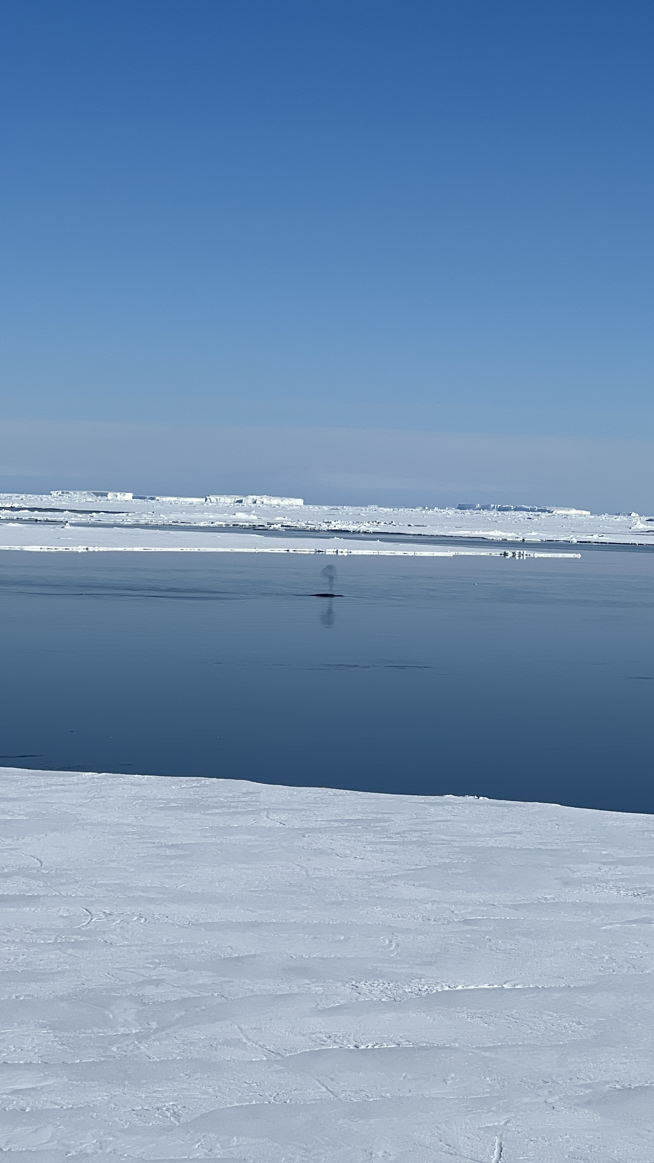
You might need to zoom in to see the group of orcas ahead of the ship
Penguins are one of the favourites of Orcas so they were all out of the water on ice drifts 
As we were sailing south to that southernmost point, a large pod of orcas was spotted ahead of us, so we all rushed to the best vantage points to see them. They are stunning creatures. Meanwhile, as we were trying to get closer to the orcas, the captain was taking us further and further south until we reached the most southerly point possible for a ship to reach - 78.44 degrees latitude, a little over 1000km to the geographic South Pole. 

We were almost up against the ice shelf (which incidentally is about the size of France). Quite a noteworthy occasion so the captain gathered us and the crew on the helipad to get a photo and drink a toast with chilled champagne; it was pretty cold -4.6C so mulled wine would probably have been better but it’s a French ship so champers it was! We stood around in the icy air for almost an hour ‘enjoying’ the moment then dashed back inside to the bar for hot chocolate. 
Eventually we sailed out of the bay to head west along the edge of the ice shelf to Cape Crozier (the eastern end of Ross island) where there’s a huge Adelie penguin colony. Unfortunately we were able to land as it's a protected breeding area for Adele penguins. Towering behind the Cape is Mount Terror, an extinct volcano on Ross Island. 
The gruesome effects of frost bite
A team of 3 brave men, the Crozier group, from the Terra Nova expedition trekked to Cape Crozier in 1911. In addition to mapping and exploring they were interested in collecting penguin eggs in order to investigate any evolutionary links to reptiles. They found a few eggs and one of the party put them inside his fur mitten. As a result he got frost bit on his fingers which swelled with fluid and froze - sheer agony. One of that small team, Aspley Cherry-Garrard, described it as ‘The Worst Journey in the World’ and indeed from his description, it must have been brutal. 
Polar exploration is a harsh unforgiving venture. I include this small advertisement which was not for that particular expedition but which attracted thousands of applicants. And it seems that each expedition seemed to attract more applicants then could be taken on board - in fact there were a few stow aways.  A boy's own adventure! 
As we were navigating further west along the Ross Ice shelf towards Ross Sea, we were treated to another cooking session; today it was Butter Brioche with the ship’s baker, Alexandre Gabriel.


Sunday 29 January 2023

January 29 Cape Colbeck and the entrance to the Ross Sea


Ever hopeful of being able disembark and explore, our hopes were dashed and today became a day of navigating further along the vast coastline of Antarctica. Ice-covered Cape Colbeck is the north-western end of Marie Byrd Land. It was discovered in 1902 and named in honour of Captain William Colbeck one of the first explorers to have over wintered in Antarctica during the Southern Cross expedition of 1899 with Carsten Borchgrevink.  The Cape marks the western side of the vast bay that contains the Ross Sea, the world’s largest marine protected area.  
In fact the whole of Antarctica - the coldest continent on earth with no capital, no language, nor population - is a ‘protected’ area made so in 1959 by a treaty, the Antarctic Treaty created and signed by 12 countries during the International Geophysical Year In 1959. Preceding the formulation and signing of that treaty, 50 research stations had been established for the purposes of exploration; many countries were keen to break new ground, identify and describe geological and geographical features of this vast southern land. The purpose of the Treaty was to ensure Antarctica remained a demilitarised zone be preserved for scientific research.  The Treaty has no expiry date and may be modified but only with the unanimous agreement of all the contracting parties. Inspections of research stations and operations are carried out regularly; in 2020 Australia inspected the operations of 6 different countries with bases in Antarctica.

Saturday 28 January 2023

January 28 Mountains, deserts, rivers and lakes - Antarctica above and below the ice

Typical map of the Antarctic continent - brown bits 'exposed' mountains, grey bits ice shelves over sea
Wright Valley in the Transantarctic Mountains - I remember the first time I saw this range - awesome!
And for a slightly different view of this frozen continent, this most southern desert - Antarctica!  It’s not all snow and ice. My learning curve did another steep ascent! Dry valleys exist in the Transantarctic Mountains. These valleys are some of the driest places on Earth and have not seen rain in two million years - does it rain in Antarctica? Unlikely but I think they are referring to precipitation. The valley floors are covered with loose gravel. One of those places is Wright Valley. At its western end lies Don Juan Pond one of the saltiest bodies of water on earth and unsurprisingly it almost never freezes. A few Kms east of this ‘pond’ is Lake Vanda, a frozen lake. The ice can be 3-4m thick and it is quite clear. Beneath that is liquid water fed by the Onyx river, the longest river in Antarctica.  I want to go there and I believe you can hike in - mais hélas pas possible, pour moi. Learning about this opens up this massive continent as vast and staggeringly, surprising, excitingly diverse to me – almost unbelievable. Antarctica really got to me.

The ice sheet is on average 2Km thick but can be almost 5km thick in some places
The Antarctic ice sheet across its vast extent is about 2 Km thick on average, but in some places this huge polar ice cap is almost 5 km thick. Lift the deep ice layer off (zingingly, mindboggling satellite and other astonishing technology) and voila the continent has a vast system of rivers and lakes. 
Lake Vostok is the largest of Antarctica's almost 400 known subglacial lakes. Bear with me as I sneak images from the internet and lectures but some of this is so incredible.
Location Lake Vostok - roughly, perhaps

Staggering - it's worth zooming in and checking out this schematic!
Lake Vostok is located at the southern ‘Pole of Cold’, beneath Russia's Vostok Station under the surface of the central East Antarctic Ice Sheet; it sounds horrendous. Southern ‘Pole of Cold’? In 1983 it recorded a temperature of −89.2°C, the lowest naturally occurring temperature ever recorded on Earth at that time. An interesting little titbit I learnt is that when the air is colder than freezing, molecules of ice and snow skip the liquid form and go straight from their solid state to gas – this is called sublimation. I love this word and this whole notion. The things you learn when you’re not in school!  (Exploring and journeying is not just about, is rarely about the food!) In the schematic image above it shows that in an ice core drilled almost 4km through the ice, they found pollen, bacteria, marine diatoms (plankton) and totally unknown 'things'.  Exciting to contemplate the history of our home planet. 
Scientists believe that Lake Vostok's sole source of water is melted ice from the ice sheet that hides the lake as it seems that there are no subterranean or sub-glacial rivers feeding it. For me that raises the question of what is melting that ice? At almost 4km below the surface of the ice?  Earth's core temperatures perhaps? There's also no way for its water to escape, making Vostok a breeding ground for underwater life.  The science and exploration behind all this is perhaps a little beyond me but .... Wow! Imagine what life forms we are yet to discover.
But here's the thing, where water flows ice flows. Obviously the ice as it accumulates, like water, is always on the move flowing to a lower point, to sea level - basic 'something' but I am no glaciologist and haven't got my head around that yet. However .. ice streams form where water is under the ice and we've just seen that there are rivers under the ice. Here's an interesting image from what we might think as a solid-state, ice-engulfed continent - climate change notwithstanding. The colours show ice movement! Thank you Dr Sue Currie.
Talk to me about glaciers!
From the depths to the peaks - but still sub-glacial! 
Mountains under the ice?! You may have contemplated this, I had not really but it stands to reason of course. The Gamburtsev Mountain Range, which is believed to have started forming around a billion years ago, is a subglacial mountain range located in Eastern/Greater Antarctica, just underneath what is referred to as the Southern Pole of Inaccessibility. Pole of Inaccessibility? Such names and concepts are logical but rarely do we think about them. Why would we?  but I can’t pass them by when they leap out at me. Just briefly the ‘Pole of Inaccessibility’, as the name suggests, is the point on the Antarctic continent that is farthest, in all directions, from the surrounding seas; it is located on the Polar Plateau in a vast territory claimed by Australia. The site almost 4000m above sea level, is occupied by a meteorological research station set up by the Soviet Union during the International Geophysical Year (1957–58). Obviously all continents have these points but it’s a concept that I only first heard about when we were traveling in Australia in 2021. In Australia, the continental pole of inaccessibility is located approximately 160 km west-northwest of Alice Springs – we got fairly close but couldn’t get to the spot with our rig – it’s inaccessible! All these concepts, facts, roll around in my head tantalising me, daring me to go to the next bit of information and  and  and .....

Not brilliant images - they were captured from lectures that had me rivetted to the screen (again thanks to Dr Sue Currie.)
The Gamburtsev Range is about the same size as the European Alps evidently and was discovered by the Soviet Antarctic Expedition in 1958 – how? I have absolutely no idea, I haven’t had time to investigate that yet. It is named for Soviet geophysicist Grigory Gamburtsev. The Range is approximately 1,200 km long, almost 3 km high and is completely covered by up to 1 km of ice and snow.   Current thinking is that glaciers began sliding down the Gamburtsev Range around 40-50 million years ago and merged to form the East Antarctic Ice Sheet, burying the entire range in the process. 
I leave you to contemplate the unknown places on our amazing planet.

January 28 Approaching Russkaya


A pearly misty morning
We woke to a misty morning, the first since setting sail. It was quite magical but the mist burnt off by mid-morning which was probably good for sailing and enabled stunning wrap-around vistas. We were heading for Russkaya Station and there was quite a distance to cover before we would reach it but that time was well spent. Lectures plus! wonderful for geeky me.
A bit of geology of the Ross sea area where we were heading eventually 
The top image is simply a hand drawing of a time where a number of continents, once part of Gondwana, were still close-ish to what became what we now call Antarctica 100 or more million years ago. The circled bit is enlarged in the bottom image showing where Australia split off - almost creating the 'space' that became the Ross Sea. That is a hugely massive and probably fanciful generalisation with many steps in between but it might give you just an inkling of an idea of how the jigsaw puzzle may have fitted together once - the land masses have formed and reformed and travelled across the planet in a crazy dance for 100s of millennia. What the enlargement shows in paler blue is mostly ice - the Ross Sea iceshelf and other ice particularly surrounding the islands that make up western/Lesser Antarctica. The thick brown swathe through the centre is the Transantarctic Mountains, which I referred to before, leading to the Weddell Sea at the top of the image to the left of which is the Antarctic Peninsula. Sorry that may not be a good explanation I appreciate, but Antarctica is such an intriguing, complicated piece of our planet it's worth trying to understand a teensy bit more of its entirety rather than the small regions constantly reported about in the Media which is predominantly the Antarctic Peninsula some of which extends outside of the Antarctic Circle - it is the extension of the Andes before the Scotia tectonic plate took off east.  It is so complex and this is in part why I am so excited to be traveling to Antarctica - I'm trying to understand this astonishing place! Without any ice, what we 'see' as Antarctica would emerge as a giant peninsula/land mass and archipelago of mountainous islands, known as Lesser Antarctica, and a single large landmass about the size of Australia, known as Greater Antarctica. These regions have different geologies.

The miracle of life in the Ross Sea
As I was saying ..... we had a brilliant lecture on the geology, ecology and productivity of the Ross Sea, the world’s southernmost sea and coastline.  Our lecturer was a brilliant marine biologist Nic Servel, I won’t bore you with the details from his engaging lectures suffice it to say he had me totally engaged.  Oh OK! I might just tell you one little titbit.  Krill, wee crustaceans, teensy-weensy prawn-like creatures, are carbon pumps!  What? you say. I know they are often talked about as essential to saving the planet but perhaps plankton might beat them to that award for creating about 80% of our planet's oxygen - but Krill just might take the carbon stakes.  Anyway .... krill are very small but extremely numerous little creatures that are part of the Arctic and Antarctic food webs and are slurped up by whales and other sea mammals and birds.  The krill eat phytoplankton – microscopic plants that live by taking carbon out of the atmosphere and mixing it with sunlight and end up producing an estimated 80% of the earth's oxygen. When krill excrete (faeces) or moult their wee exoskeletons, those materials sink down in the ocean and the carbon in these little goodies is locked away in the deep sea. 

This might give you a laugh but probably won't surprise you - I, along with 3 other regulars plus Lindsay of course, sat in the front row of the theatre for every lecture - whoa betide anyone who sat in 'our' centre seats. It really was a bit funny, like school and it became a bit of a joke amongst some of the passengers but we were all eager beavers lapping up all they could tell us and there were some absolutely outstanding lectures. But it was not all 'intellectual', this morning we went straight from carbon pumps, inorganic nutrients, diatoms, silver fish (actual fish!) and krill to choux pastry in a few easy steps (just down the passageway) and voila! Such is life when we’re not out in zodiacs or walking on ice. Our clever Breton pastry chef, Alexandre shared his secrets on making a perfect dough for ‘choux’. It was fascinating to watch and the best part was eating what was made afterwards! 
No words required except to say this little sugary morsel was washed down with French cider!
I know this might sound a bit like - and then …. and then …. and then .... but I thought you might be interested to share a fairly typical day onboard. So …..  there's always breakfast with a sensational view at which we showed great restraint - usually, well me at least expect for the wee daily smoothie made with almond (or other nut milk) with all manner of different concoctions of fruit and/or vegetables. Absolutely delicious.  
This smoothy shot had beetroot in it plus plus today - yum
Today there was a waiter on duty who I hadn't seen before, John (there are two restaurants on board). He came up to me and said "Madam, do you know flowers grow in Antarctica?"  The lovely man handed me a flower made from a serviette (it's my grandmother image I think). I was so touched and talked to him about his skill. He then proceeded to make me an origami crane and so I told him what the Japanese paper crane represented - longevity, happiness, peace and good fortune.  FFWD to our second last day onboard he was in the restaurant again, I hadn't seen him since the flower gift and wanted to thank him and say adieu and the darling man made me wait while he made me an origami penguin to take home.  We had many beautiful staff taking care of us some of whom we ran into again at the airport in Christchurch. While we were queued in that seemingly endless check-in line I heard someone call "Madam Heather, Madam" and there was a string of them lining up to catch a plane home to Manila after 8 months onboard away from their families. Boy, they work so hard. We had quite a chat - surprise surprise! I know small things eh but it's the people who add that little je ne c'est quoi, n'est-ce pas? (indulge me we were on a French ship)
Breakfast was followed by the Ross Sea lecture and pastry fun (which I've told you about already). After lunch we were treated to another rather stunning lecture and slide show from Sue Flood sueflood.com who was one of Ponant's Photo ambassadors onboard. She is an award-winning photographer and filmmaker whose work continues to take her literally all over the world. She spent 11 years with the BBC Natural History Unit, working on series including The Blue Planet and Planet Earth as well as the Disneynature movie Earth with Sir David Attenborough. She showed us behind the scenes from some of those series and her experiences so you can imagine what a sensational show we were privy to.  She and her colleague Cindy were on board to help us with our photographic 'issues'.
But back to the start of this day when we were heading to Russkaya …. I know I do get diverted!  This is a former Soviet Antarctic research station built in the late 1970s. As far as our expedition leader, Florence Kuyper, was aware it was abandoned but she was reluctant to land there and explore without trying to contact them for permission to approach the Station. I’m not sure who she eventually got onto but she was told that it was a summer base (as it turns out however it was officially abandoned in 1990). When we got close it became apparent that landing and getting to the Station would be quite difficult as it was quite high on the rocky cape and a few Km in. So after we had a good look from onboard we sailed on.  In the meantime a long way out to sea we spotted a Chinese icebreaker. Our Captain radioed them as a courtesy. They were a bit evasive about what they were doing and where they were heading but evidently there’s a new base near there and they may have been supplying that.  It was all a bit mysterious!
Russkaya 'station' is high on that high on that hill (you need to zoom in). 
The day ended, well not actually ended but before cocktail hour at least! with a lecture rather enticingly entitled ‘Frozen South (Glacial and Land Ice)’ give by the ship's geologist, Dr Sue Currie. She was a bit of a hero for me as you can imagine.  She has a Doctoral degree in Geology from Cambridge and before choosing a life on expedition cruise ships as a geologist (what a perfect life), she worked as a geologist in the UK offshore oil and gas industry then as a senior geologist in the UK Govt Dept of Energy and Climate Change and served on the Fellowship and Validation Committee of the Geological Society of London. What credentials! I was quite in awe of her. Actually many of our guides and all of our lecturers came with pretty impressive backgrounds. You can imagine Sue’s lectures were riveting – I felt a bit like her groupie. Fortunately, she didn’t mind my flood of questions. I’ll tell you about that lecture next post (in case you want to skip it!!).

Friday 27 January 2023

January 27 Siple Island and the Getz ice shelf


We opened the curtains to this!
This morning the Captain 'drove' the ship onto pack ice around the Getz Ice shelf which separates Siple Island from the coast of Marie Byrd Land. Siple Island is a 'potentially' active volcano 3km high and is joined to the continent with thick ice. It looked pretty harmless when we were there but you never know ….. We disembarked straight onto the ice - it was a strange and quite an exciting experience, and then we simply wandered in the sun for hours. Not far away in a little lagoon of open water behind the ship, we saw Minke whales cruising back and forth; their blows looked dark against the blinding white of the snow and ice. 

The ship looked/is so huge
Mt Siple
Heading off to the volcano many km away!
Vast and empty - glorious!
The volcano is that way.
An amphibian rescue vehicle equipped with medical emergency material

A rescue/transport ice vehicle
The depth of the ice is tested before any passengers walk on it (this is a demo)
Lindsay tried to budge the ship to no avail - hahah
..... it still wouldn't shift
The polar plungers had to walk a fair way to get to the 'Plunge Marquee' - and back again! Other passengers weren't allowed to go down there.  Strange and disappointing. We had intended doing the plunge but the ship's doctor said 'no' which was mighty disappointing at the time but looking at this I'm not sorry. A few Minke whales were interested in what we were doing but they kept their distance from the plungers!
A small blow from one of the Minke whales. Tranquility
A gloriously calm inlet in the ice.
It was such a glorious day that our expedition leader decided to stay there till early afternoon and set up a table of champagne - I know, more champagne but it’s a French ship right? And very Charcot. It was a slow easy day. 
R. Our Expedition leader and cruise director sat down to bubbles Charcot-fashion
(L. Bubbles on the ice beside Le Francais on Charcot's 1903-05 expedition)
As with most things Antarctic, Siple Island is named for an explorer, Paul Siple who was also a geographer and involved with a number of Antarctic expeditions particularly in the late 1920s and early 1930s. Our travel is a series of living history and geology/geographical lessons. It’s perfect and navigating through the ice adds something quite special, a unique experience for us.
A large tabular iceberg trapped in pack ice in late January. It's not going anywhere for a long time
One of the best dinner tables in the world. 
 
Today afternoon tea was Spanish charcuterie 
As with most days, we had a recap about the day's activities followed by a briefing for the coming day. Tomorrow we are heading for Cape Burks and an 'abandoned' Russian station.

December 31 what happened next?

What's been happening in the three month between arriving home and the end of this travel-packed year?  We haven't been idle - surpr...