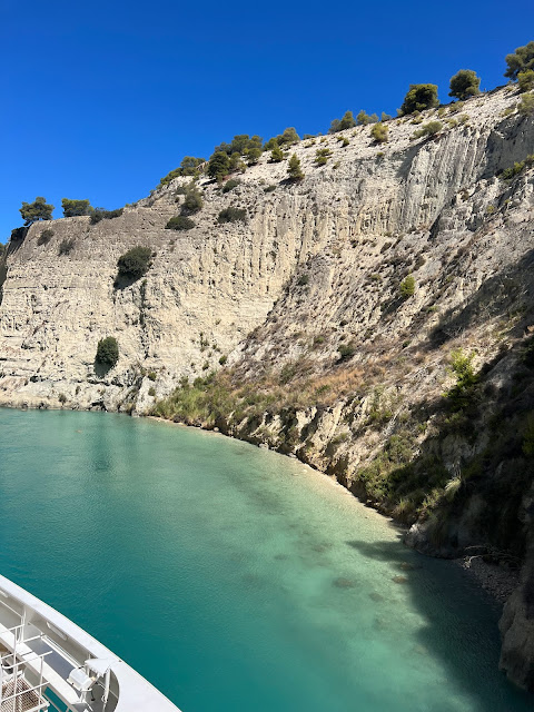
This morning we were all up on deck to watch our approach to the Corinth Canal. Fascinating watching as a tiny tugboat lashed itself to our ship and also to watch as vessels lined up to enter the Canal - the traffic was eastward-bound when we arrived which meant we had to wait. The Canal, an extremely narrow strip of water sandwiched between tall ochre cliffs, cuts through the Isthmus of Corinth, connecting the Gulf of Corinth in the northwest with the Saronic Gulf in the southeast. As a matter of interest, its construction/excavation preceded the building of the Panama Canal by 20 years.
 |
| Waiting to enter the Canal ahead |
 |
| Cars and people were lined up either side of the Canal waiting to cross presumably via a 'punt'. |
Before the Canal was built, depending on where they were coming from ships were forced to make anything up to 700 nautical miles long dangerous journey around the Peloponnese Peninsula. Then around 600 BC, Periander reportedly one of the great rulers of Corinth (but also a tyrant), had the brilliant idea of taking ships out of the water and pulling them overland on wheeled wagons across the Isthmus on a ‘road’ partially paved with stone (undoubtedly slaves did the lion’s share of pulling). The track was called the Diolkos. Evidently parts of it are still visible but we didn’t see any sign of them. We did however see what was supposedly part of the port on the Saronic Gulf side when we took a bus tour from Athens to Corinth two weeks earlier. Centuries later in 67 AD, the Roman Emperor Nero attempted to have a canal dug between the ports using 1000s of slaves, but the project was soon abandoned. Apparently this labour-intensive overland ship-transporting system was used until about the C9, by which time ships had become too large to haul. In 1882 work began as a joint venture between Greece and Hungary on digging out, mostly by hand, the Corinth Canal. It was opened 11 years later in 1893. Today along it gives passage to thousands of tourists ships it is too narrow for modern ocean freighters, as it can accommodate ships only up to 17.6m wide. As we sailed through we sometime thought we'd scape the sides - we just fitted I reckon.
 |
It seemed as if we would scrape the sides it is so narrow. Navigation lines are placed along the Canal length (red arrow)
|
 |
| Only two weeks earlier we had peered down from that bridge at this narrow trough. |
 |
| Just above our heads people were lined up to bungy-jump into the Corinth 'canyon'. |
 |
| Amazingly there was some vegetation clinging to the steep slopes on the Canal. |
 |
| Here I think a cliff collapsed. Our ship was drawn off course by the change in current |
 |
| Some shoring-up and new construction along the canal. 'Zaxarias '- a little graffiti carved into the walls. |
The Canal is quite a phenomenon and of course is a popular tourist attraction – our progress was watched by people hanging over the edge of bridges we passed under. It really is worth experiencing.
 |
| .... and two hours later we popped out into the Gulf of Corinth |
Two hours later we emerged into the Gulf of Corinth. Before we left the Gulf of Corinth, we passed under the massive Rio–Antirrio Bridge. It is the world's longest multi-span cable-stayed bridge. Its official name is the Charilaos Trikoupis Bridge. It is quite something to behold.
 |
| Charilaos Trikoupis Bridge. The world's longest multi-span cable-stayed bridge |
It had been a fascinating day and it wasn't over yet. On board we had a Professor of History, Geography and Geopolitics, Sebastien Bertrand. Over a number of days he talked to us about the ancient Aegean and Adriatic Seas, the discoveries, the battles for domination etc, all places that we would be navigating through on this voyage. If that wasn't enough (and I was already quite happy), as with all our days at sea we were tempted with 'Tea Time' (on a French ship?). Today it was
Mille feuilles (one of my favourites). Later during the cocktail hour we were able to do a tasting of
Pata Negra, famous Iberian cured ham. Life's not too bad on board!


No comments:
Post a Comment